
Roman aqueduct of Sexi
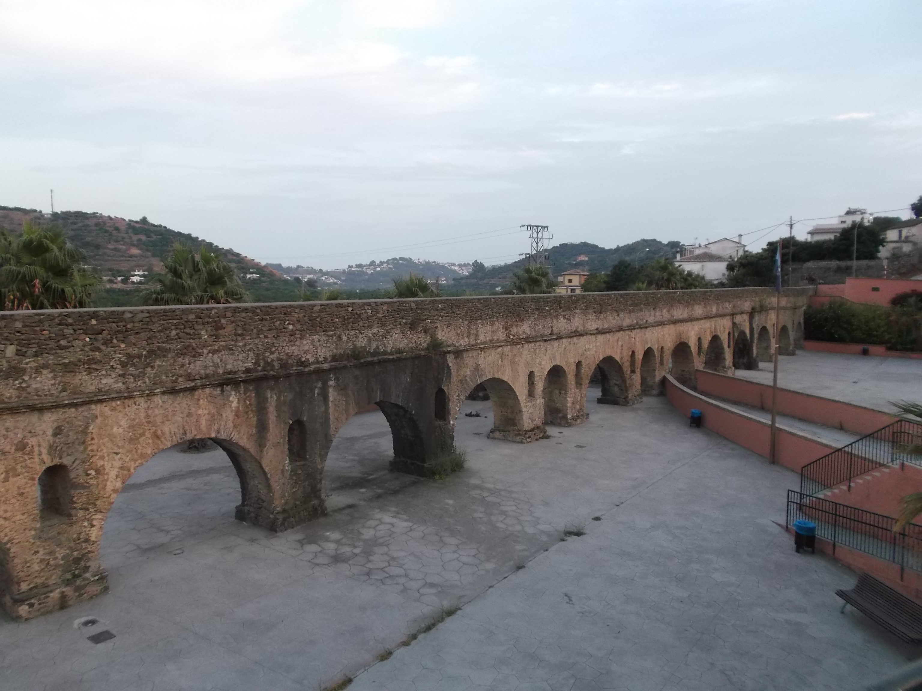
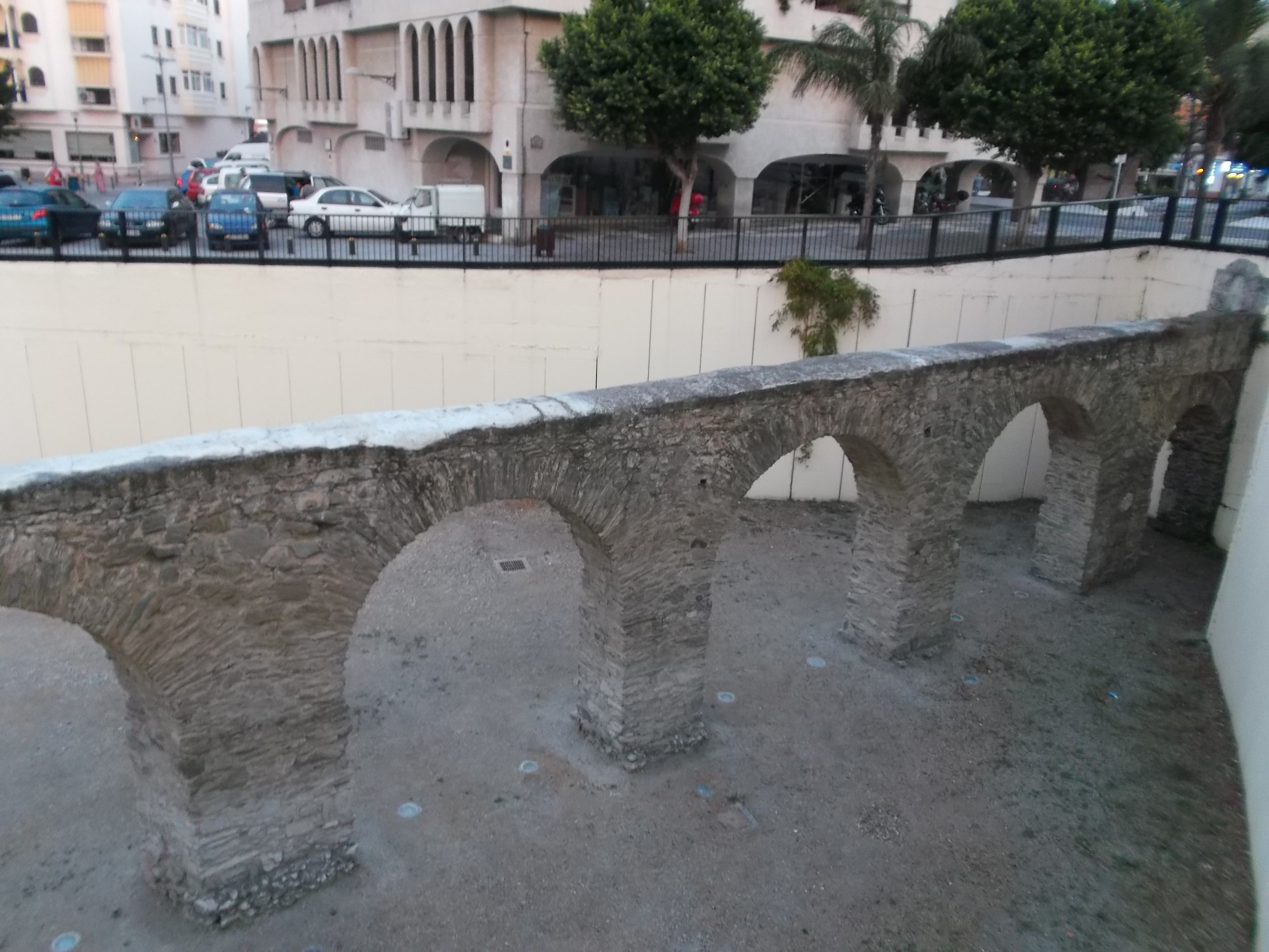
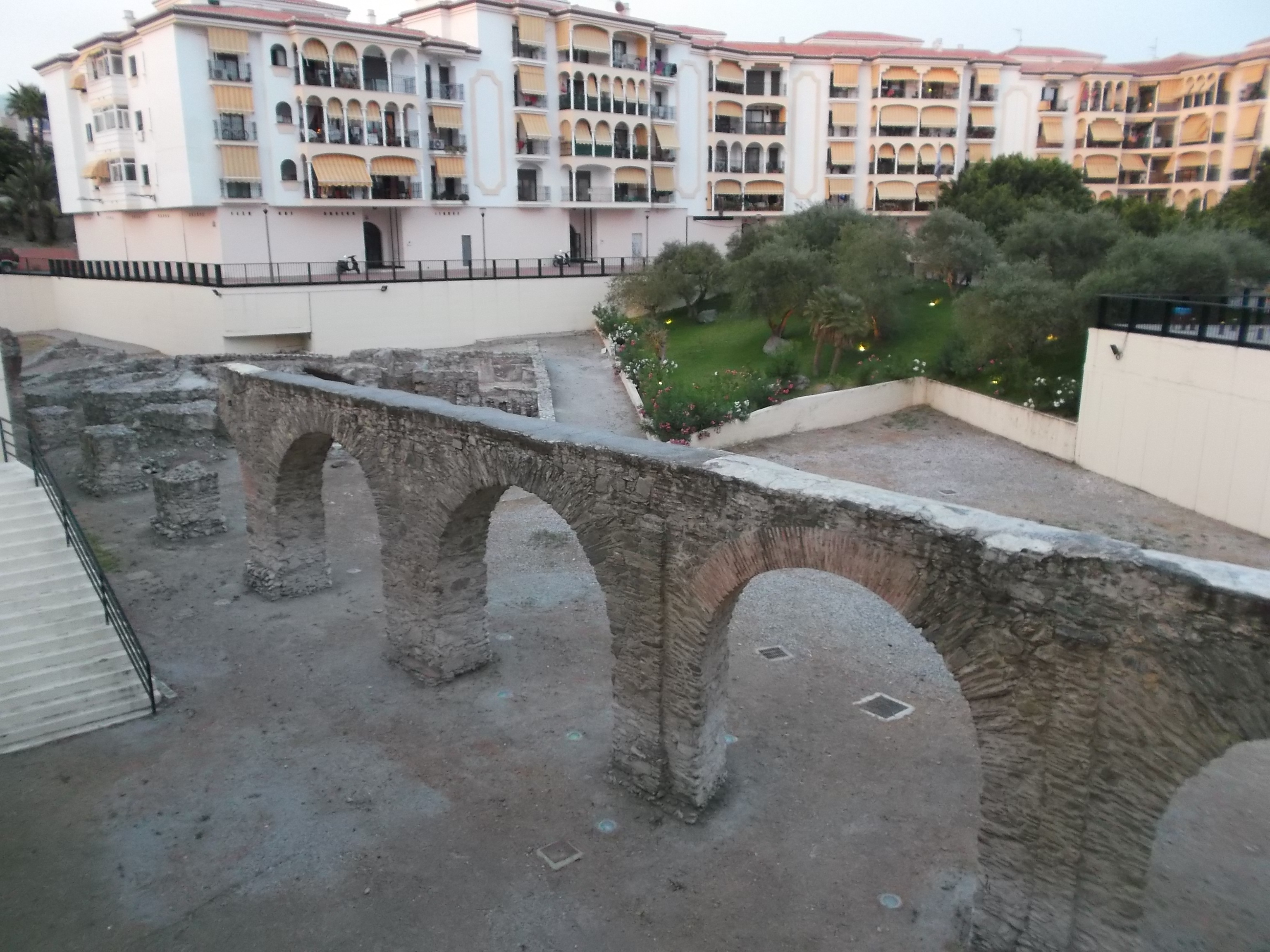 The Roman Aqueduct of Sexi is located in the municipality of Almuñécar (Province of Granada, Andalusia, Spain), conserving itself from it several sections: one in the neighborhood of Torrecuevas, another in the urban area of Almuñécar and two others remaining between the Torrecuevas neighborhood and the city of Almuñécar, in the midst of tropical tree crops (cherimoya, avocado, mango) of the Sexitan vega. Its function was that of water supply to the city, in the time of the Roman Empire. It is the best preserved Roman aqueduct in Andalusia. It is Bien de Interés Cultural from 1931.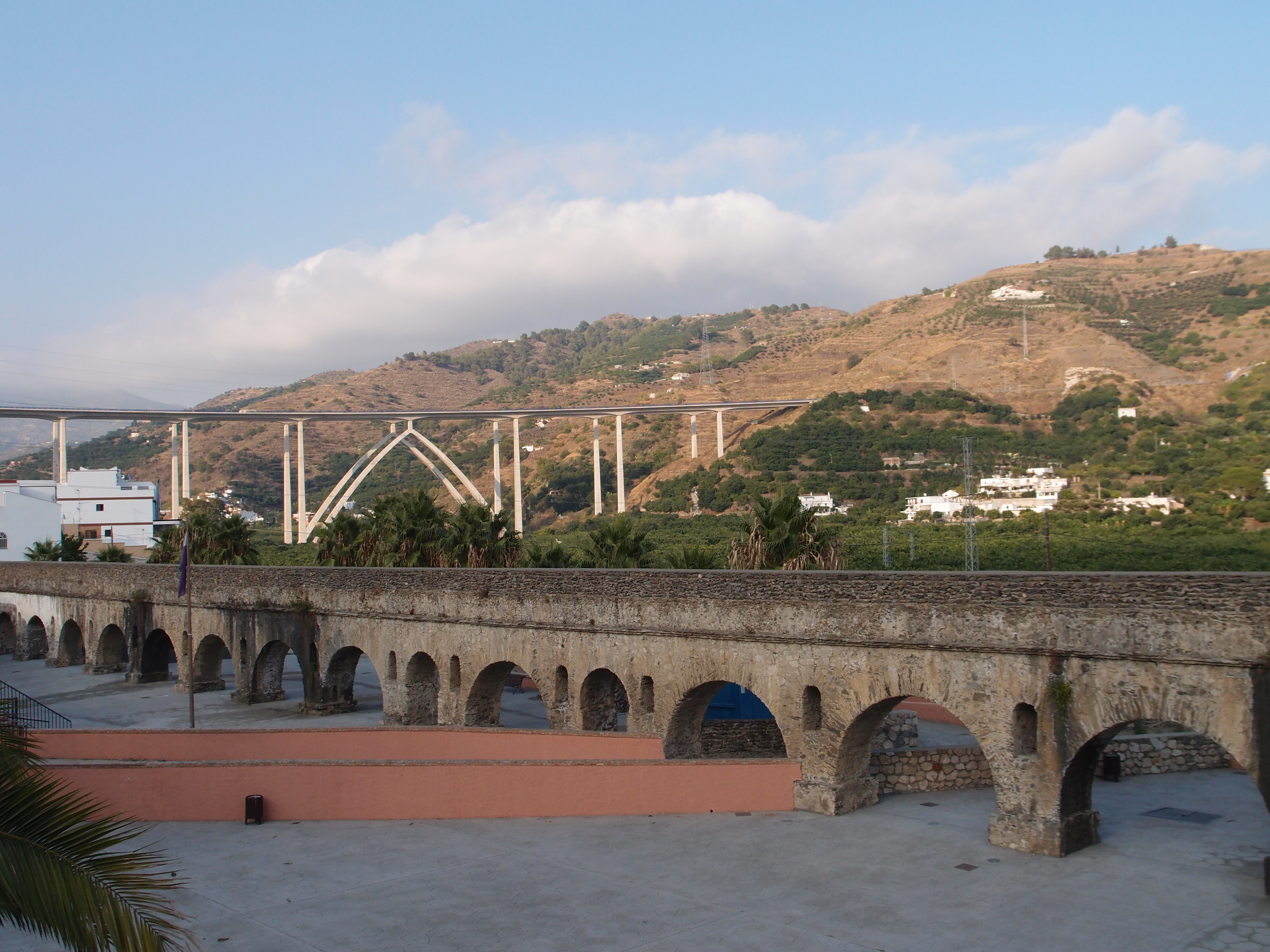
Description
The Roman Aqueduct of Sexi had a length of approximately 7 kilometers from the site known as Las Angosturas, the final point of the catchment, to the terminal deposits in the city. The water transported came from the aquifer of the Verde River and was collected through an infiltration gallery that surfaced at the site known as the Fuente de los Granados. At the end of the subvalue collection gallery, the water was conducted to the city by vaulted channels that operated in a free-sheet regime following the level curves of the terrain, sometimes almost superficial and others buried a few meters away. Special devices, such as sub-pieces and arcuations, were used to save depressions when it was considered necessary, four of them have been studied in detail for its monumentality. It is also known that it had a tunnel that allowed the passage of the canalization of the basin of the Verde River and that of the Seco River. The final part of the pipeline ended with an inverted 1-kilometer-long siphon made with ceramic tubes and possibly with a column-breaking device at the end.
Part of the ancient canalization has continued to function until today as a ditch for the irrigation of the rich fertile plain, reason that explains the conservation of a large part of its extra-urban elements and that makes it the best preserved Roman aqueduct in Andalusia.
The four aqueducts that make up the complex, Torrecuevas and the so-called sections I, II and III, downstream of the Seco River, constitute a work of great unity. They present two types of arches: one with normal light of 4.90 meters and another with reduced light of 2.80 meters. The pillars of square section measure 1.80 by 1.80 meters and, when their height exceeds 5 meters, which is approximately three times the transverse dimension, are linked together by the intercalation of a second body in the lower area. This direction finds stylistic similarities with that of Baelo Claudia, especially in the lightening arches on the pillars, a rare detail in the Roman aqueducts. Fernández Casado dates back to the 1st century AD, so Almuñécar could be given a similar chronology.
History
The first study carried out on the route of the aqueduct is the work of engineer Carlos Fernández Casado, who published in 1949 in the Archivo Español de Arqueología an article in which he described and analyzed the conserved remains of it, pointing out the necessary existence of a system of inverse siphon to allow the water to save the valley that extends at the foot of the hills on which Almuñécar settled in Ancient times.
A second proposal was presented by Antonio Tovar Sabio and Tomás Camero Uclés as an end-of-career project in the 1980s, under the title «Conducción romana de Sexi», which describes the remains preserved at that time of the aqueduct.
In 2000, the latest study on driving with a new layout proposal was published, the work of Federico Molina Fajardo, a municipal archaeologist from Almuñécar for two decades, who collected in his analysis the data obtained from the excavations carried out in the town. As a new contribution is the excavation carried out in what both Torres Balbás and Fernández Casado identified with the castellum aquae, the remains known as Cueva de los Siete Palacios; hypothesis that discarded when not appearing any trace of hydraulic mortar in the construction. It also describes the archaeological remains exhumed in the different excavation campaigns carried out in the area of La Carrera, specifically the venter of the siphon, whose existence was already pointed out in the forties.
Sections
Torrecuevas Aqueduct
Upper section of the Roman aqueduct, 130 meters long, 17 arches of normal light and 2 of reduced light at both ends, made of slate masonry. The delimitation is extended 300 meters towards the south to include remains of canal that are under the highway and two small sections of arcades.
Already in the neighborhood of Torrecuevas the next rest of specus is located, discovered thanks to an archaeological excavation carried out in June of 2008 in a place known as El Convento; a section of 75 meters of vaulted channel of 1.00 meters internal height and between 0.36 and 0.40 meters wide at the base.
After crossing the Suspiro del Moro road, the channel appears elevated on the so-called Torrecuevas Aqueduct, arcuate 130 meters long. From this construction, the conduction runs underground through cultivated lands and under buildings of recent construction along almost all its route to the change of basin, appearing in a timely manner on a possibly reconstructed arch; a Health; elevated over a work of four arches in Juan Salado's land and a spiramina of 4 meters deep.
I, II and III Aqueducts
Towards the south three stretches of the Roman aqueduct are known. The AI has a single body, with 4 normal light arcs and 2 small ones. The AII consists of 9 normal and 2 reduced arches. The section of more height presents/displays three arcs of reinforcement between the pillars. The AIII is formed by two bodies with 9 main arches and two reduced ones. The delineation includes remains belonging to the manholes and siphons that would mark the aqueduct along its route.
First section
It corresponds to the collection gallery of the aqueduct, whose final point is located in the well-known one as Fuente de Los Granados, being nevertheless discussed its initial point.
Second section
From the Fuente de Los Granados fountain, the water flows through a free-flowing system through a new construction ditch that is supposed to reuse, at least in part, the layout of the Roman-era aqueduct.
Third section
The channel of Roman invoice appears, along about 200 meters, in the vicinity of the farm of «Los Fonollá», coinciding with the beginning of a sector excavated in the rock of about 30 meters in length. Throughout this first sector, the vaulted channel shows 0.40 meters wide at the base and a variable height between 0.80 and 1.00 meters measured from hearth to intrados of the vault.