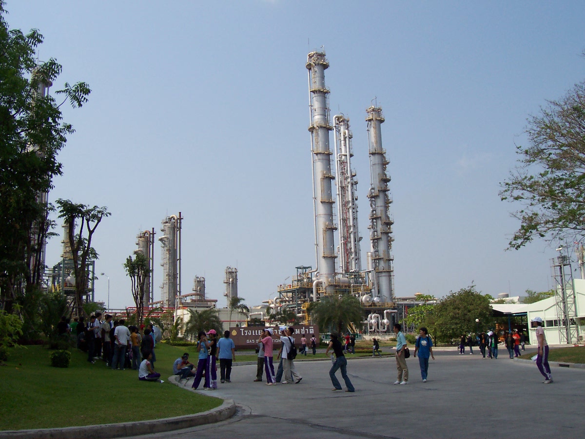
Eastern Thailand conurbation

The Eastern Thailand conurbation stretches along the Eastern Seaboard of the Gulf of Thailand, from Mueang Chonburi district to Si Racha and Laem Chabang, through Sattahip district, linked by rail and highway infrastructure to the industrial port complex at Map Ta Phut, which itself forms a single conurbation with Rayong city. The region contains more than eighty separate local administrative organizations (LAOs) with a combined population of over 1.8 million across an area of roughly 3,274 km². It should not be confused with the Eastern Economic Corridor (EEC), the special economic development zone established by statute over the same three provinces (Chonburi, Rayong, and Chachoengsao); the EEC is a policy and investment-promotion regime with a narrowly economic mandate, whereas the Eastern Thailand conurbation refers to the continuous built-up area and its constituent local governments.
The region forms the industrial and tourism core of Thailand's east coast, anchored by the deep-sea port of Laem Chabang, the petrochemical complex at Map Ta Phut, and the resort city of Pattaya. Rapid industrialisation since the 1980s Eastern Seaboard Development Program, followed by the designation of the EEC in 2018, has driven sustained population growth and urban sprawl across the coastal plain, drawing in industrial estates, workers' housing, and tourism infrastructure that now form a nearly continuous urbanised strip linking Chonburi city, Pattaya, and Rayong.
As with the Chiang Mai Metropolitan Area, the region's administration remains fragmented among dozens of independent local governments, none of which holds general planning authority across the conurbation as a whole. This has produced recurring difficulties in coordinating region-wide infrastructure, including wastewater treatment, solid waste disposal and land-use planning, even as the central government has, through the EEC, imposed a single consolidated land-use plan on the three provinces from above.
Geography
The Eastern Thailand conurbation occupies the low coastal plain and adjoining hills of the Gulf of Thailand's eastern shore, roughly 80 to 220 kilometres southeast of Bangkok. It spans several districts across two provinces, such as Mueang Chonburi, Bang Lamung, Si Racha, Sattahip, Ban Chang, and Mueang Rayong. Along the coastline itself, urbanisation is largely continuous. A near-unbroken strip of municipalities links Chonburi city, the Laem Chabang–Si Racha industrial and port corridor, the Pattaya–Bang Lamung tourism strip, and the Map Ta Phut–Rayong industrial belt, each municipal boundary meeting the next along the shore road.
Inland, the built-up area is considerably more discontinuous. Some of the intervening gaps visible in built-up density mapping reflect permanent topographic and conservation constraints, the hills bounding the coastal plain to the north and inland areas set aside as protected forest, which are unlikely to be developed regardless of future growth. Other gaps, however, consist of flat, undeveloped land with no such constraint; the largest of these, a roughly flat tract in Huai Yai subdistrict lying between the Si Racha–Laem Chabang cluster, the Pattaya–Nong Prue cluster, the Nikhom Phatthana–Pluak Daeng industrial belt, and the Map Ta Phut–Rayong complex, was selected in 2025 as the site of a planned new town intended explicitly to fill this space and physically link the surrounding clusters.
Economy and industry
The region is one of Thailand's principal industrial and logistics zones. Laem Chabang, in Si Racha district, is Thailand's largest deep-sea container port, and is undergoing a third-phase expansion intended to raise its annual container capacity to roughly 18 million TEU. Further south, the Map Ta Phut industrial estate in Rayong forms the country's largest petrochemical and heavy-industry complex, and its associated deep-water port is likewise being expanded to increase capacity for natural gas and liquid cargo. Along the coast between the two industrial poles, Pattaya and neighbouring Bang Lamung township form one of Thailand's largest tourism economies, drawing close to 15 million visitors annually.
Since 2018 the government has designated twelve target industries for the wider Eastern Economic Corridor, including next-generation automotive and electric vehicles, robotics, digital services, and medical services, alongside the area's traditional petrochemical and automotive manufacturing base. A flagship transport project intended to serve the region, the High-Speed Rail Linking Three Airports (Don Mueang–Suvarnabhumi–U-Tapao), was approved in 2018 to connect U-Tapao International Airport near Rayong to Bangkok's two main airports at speeds of up to 250 km/h, at a project cost of roughly 224.5 billion baht. As of mid-2026, the project remained more than seven years behind its original schedule. The private concessionaire told the State Railway of Thailand and the EEC Office in June 2026 that it could not secure project financing after lenders judged the scheme commercially unviable, leaving the government to decide whether to amend or terminate the concession contract.
In July 2025 the EEC Office announced the "EEC Business Center and Livable Smart City", a planned 1.34-trillion-baht new town on a 2,339-hectare site in Huai Yai subdistrict, Bang Lamung district, a still largely undeveloped area lying roughly equidistant between the Si Racha–Laem Chabang industrial-port cluster to the northwest, the Pattaya–Nong Prue tourism cluster to the west, the Nikhom Phatthana–Pluak Daeng industrial belt to the north, and the Map Ta Phut–Rayong petrochemical complex to the southeast. Nicknamed "Bangkok 2", the project is intended to accommodate up to 350,000 residents and create over 200,000 jobs by the 2030s, positioned explicitly to relieve congestion in Bangkok, Pattaya, and Rayong.
Urban challenges
As in the Chiang Mai Metropolitan Area, the region's rapid growth has outpaced the capacity of its many independent local governments to plan and finance infrastructure at a scale matching the built-up area they collectively administer. The EEC's overlay of a single consolidated land-use plan has not resolved this underlying fragmentation. Day-to-day responsibility for roads, waste collection, water and wastewater services, and local by-laws remains divided among more than eighty separate municipalities and subdistrict administrative organizations, each operating independently of the others.
Fragmented infrastructure management
Solid waste and wastewater management are handled separately by each constituent LAO, with treatment capacity in some areas failing to keep pace with population and industrial growth. A 2020 assessment by the Rayong Provincial Administrative Organization found that eight separate municipalities in the Map Ta Phut–Rayong industrial belt, including Rayong City, Map Ta Phut, Noen Phra, Ban Chang, Thap Ma, and others, together housed over 316,000 people and produced large volumes of wastewater without a unified treatment system, degrading water quality in the Rayong River and threatening a reservoir used for the province's domestic water supply. Solid waste management shows the same pattern. A 2022 public-consultation process for a waste-to-energy cluster serving Pattaya required coordination across three separate districts (Bang Lamung, Si Racha, and Sattahip), each under different LAOs. Residents in some already-industrialised areas have also reported contamination linked to the eased land-use restrictions. In Ban Bueng district, Chonburi, residents near a recycling facility reported persistent odours from metal burning, and testing they commissioned themselves, later corroborated by a government agency, found soil salinity and heavy-metal concentrations, including mercury, lead, cadmium, and manganese, well above standard levels, coinciding with die-off of nearby eucalyptus trees and livestock.
Land-use planning and public participation
Land-use planning has followed a different but related path. Because ordinary town planning under the Town Planning Act B.E. 2562 (2019) is normally adopted separately by each municipality or province, the government instead used special executive powers in October 2017 to revoke the existing municipal and provincial land-use plans across all three EEC provinces and directed the Department of Public Works and Town and Country Planning to draft a single consolidated plan for the whole area, bypassing the public-participation procedures of the ordinary process. A network of eight village groups from across the three provinces publicly objected to the draft plan in July 2019, calling on the government to disclose it and allow affected residents to comment before it was adopted.
Environmental groups have argued that the resulting plan, finalised in December 2019, was drafted at a scale too broad to address local conditions, and that it reclassified substantial areas of productive farmland, including brackish-water rice and aquaculture land at Khao Din in Bang Pakong district, as industrial zones without meaningful consultation of affected residents. Academic analysis of the EEC's planning framework has likewise concluded that overlapping and unclear lines of authority between the EEC Act and the ordinary Town Planning Act have produced persistent legal and procedural confusion over which body is responsible for land-use decisions in the region.
The dispute escalated into formal legal action. In July 2020, a network of residents from villages across all three provinces, including Khao Din in Bang Pakong, Nong Tin Nok in Ban Pho, Khao Hin Son and Nong Naen in Phanom Sarakham, and areas of Bang Lamung and Si Racha, filed suit at the Supreme Administrative Court seeking to revoke the consolidated EEC land-use announcement, arguing that its drafting process had not provided the meaningful public participation required under Thai town-planning practice before agricultural and residential land was reclassified for industrial use.
Legacy as a precedent
The EEC's planning process has since become a reference point in disputes over other centrally-imposed regional development schemes. In late June and early July 2026, protesters from the eastern provinces and from southern Thailand camped outside Government House under the banner of a "People's Network to Stop the Land-Selling Law", explicitly citing the EEC's land-use outcomes as a cautionary precedent while opposing a proposed Southern Economic Corridor Act and associated Landbridge project, as well as a plan to extend EEC-style development into neighbouring Prachinburi province. The protest ended on 1 July 2026 after the government agreed to withdraw the pending Southern corridor bill and establish a new planning committee that includes civil-society representatives.
Population and administration
The Eastern Thailand conurbation is not a single, unified administrative entity. Rather, it is a functional urban area composed of more than eighty separate local administrative organizations (LAOs), each with its own elected council and executive and its own statutory land-use plan. As of the region's current administrative arrangement, no single metropolitan authority has general governing power over land use, public services or planning across the entire conurbation.

Statutory Land-Use Classifications:
Commercial Center Zone
Urban and Community Zone
Urban Expansion Zone
Rural Community Zone
Industrial Development Zone
Special Economic Zone for Industrial Activities
Special Economic Zone for Special Activities
Agricultural Promotion Zone
Forest Conservation Zone
Land Designated for Reform by Royal Decree
Water Bodies and Reservoirs
Open Space for Environmental Quality Conservation
Island and Marine Tourism Zone
Military and Naval Zone
Local government in Thailand follows a two-tier, decentralised system established mainly by the Provincial Administrative Organization Act B.E. 2540 (1997) and the Municipality Act B.E. 2496 (1953, as amended). Within the region shown on the map, individual LAOs fall into three general categories. Provincial administrative organizations (PAOs), one per province, have limited province-wide competences; municipalities (thesaban) are subdivided into city (thesaban nakhon), town (thesaban mueang) and subdistrict (thesaban tambon) municipalities on population and revenue thresholds; and subdistrict administrative organizations (SAOs/TAOs) cover areas not incorporated into a municipality. Each numbered boundary on the map represents one such LAO. These bodies operate independently of one another; horizontal cooperation between them is not mandated by the Constitution or by national legislation, and such coordination as exists is informal or organised through the centrally-appointed provincial governor rather than through any elected regional body.
Because the entire region falls within the three provinces covered by the Eastern Economic Corridor (Chonburi, Rayong, and Chachoengsao), statutory land use here is not determined separately by each constituent LAO, unlike the normal practice elsewhere in Thailand under the Town Planning Act B.E. 2562 (2019). In October 2017 the government invoked the special powers of Section 44 of the interim charter to revoke the existing municipal and provincial city plans of the three provinces, directing the Department of Public Works and Town and Country Planning (DPT) to prepare a single, consolidated land-use, infrastructure, and public-utilities plan covering the whole EEC area, a process that bypassed the public-participation requirements of the ordinary town-planning process. The colour-coded classifications visible on the map therefore reflect this single consolidated plan rather than a mosaic of separately adopted local plans.
The one body with authority spanning multiple LAO boundaries in the region is the Eastern Economic Corridor (EEC) itself, established under the Eastern Special Development Zone Act B.E. 2561 (2018). The EEC is administered by the Eastern Special Development Zone Policy Office (formerly the Eastern Economic Corridor Office, EECO), an independent public agency reporting directly to the Prime Minister, under the policy direction of the EEC Policy Committee. Even so, the EEC's authority remains narrowly economic in scope rather than that of a general-purpose local government. Beyond the consolidated land-use plan, its mandate covers the promotion of investment, the designation and management of promoted industrial and infrastructure zones, and the streamlining of approvals within those zones. It does not replace the constituent LAOs as providers of general municipal services, roads, waste collection, local by-laws and so on, which remain the responsibility of each municipality, SAO, or PAO. Consequently, day-to-day administration of most of the region continues to rest with the fragmented set of LAOs described above, with the EEC and its consolidated land-use plan acting as an overlay focused on investment-driven development rather than a substitute for general local governance.
The table below lists the constituent local government units of the Eastern Seaboard Urban Region, together with their population, area, and administrative status.
Legend |
|---|
No. |
01 |
02 |
03 |
04 |
05 |
06 |
07 |
08 |
09 |
10 |
11 |
12 |
13 |
14 |
15 |
16 |
17 |
18 |
19 |
20 |
21 |
22 |
23 |
24 |
25 |
26 |
27 |
28 |
29 |
30 |
31 |
32 |
33 |
34 |
35 |
36 |
37 |
38 |
39 |
40 |
41 |
42 |
43 |
44 |
45 |
46 |
47 |
48 |
49 |
50 |
51 |
52 |
53 |
54 |
55 |
56 |
57 |
58 |
59 |
60 |
83 |
84 |
Total |